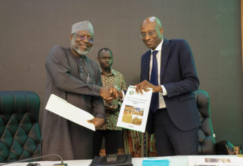
The Soil Fertility Stewardship (PAGRIS) project in Burundi, implemented by IFDC, recently collaborated with the Institut des Sciences Agronomiques du Burundi (ISABU) and the Burundian Ministry of the Environment, Agriculture, and Livestock (MINEAGRIE) to produce soil maps for the country. The new Soil Acidity and Soil Fertility maps — which vary by agroecological zone — are intended to improve the understanding of the current problems of acidity and declining soil fertility in Burundi.
Soil Fertility in Burundi
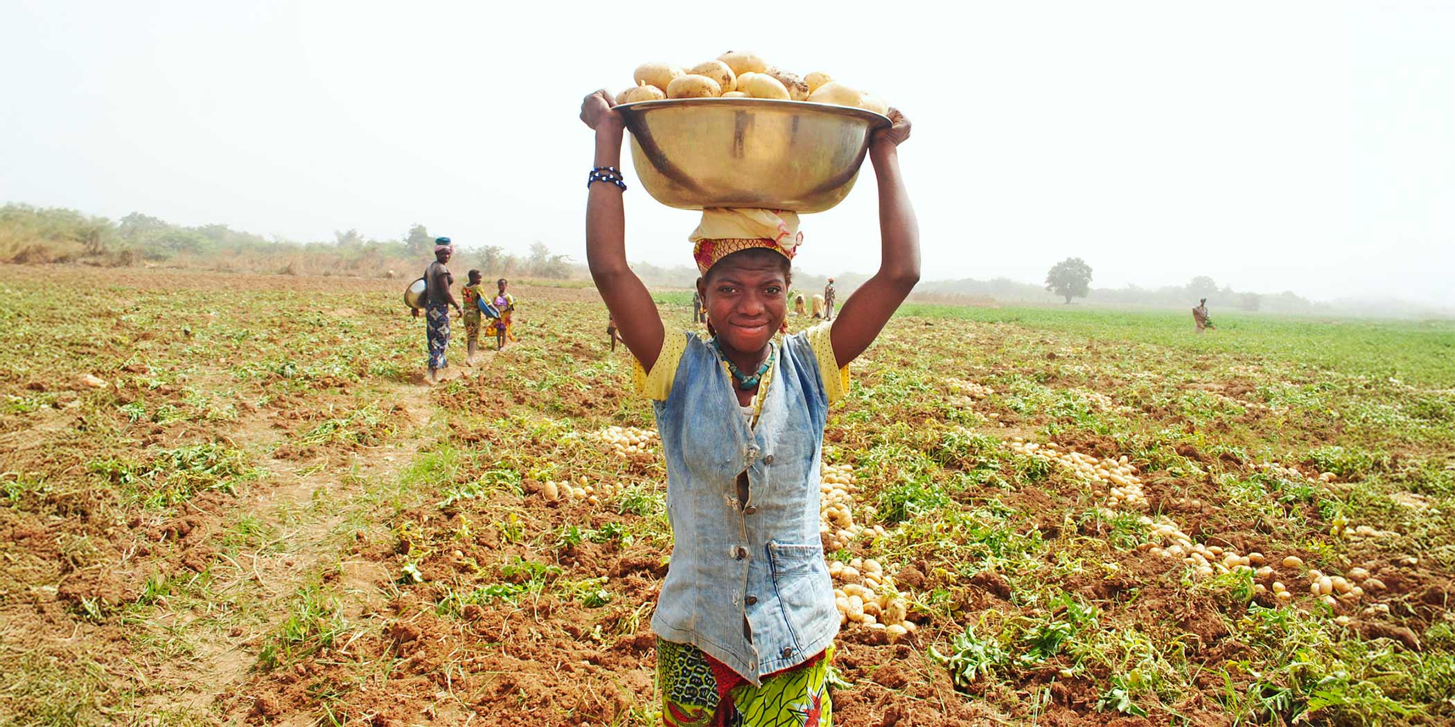
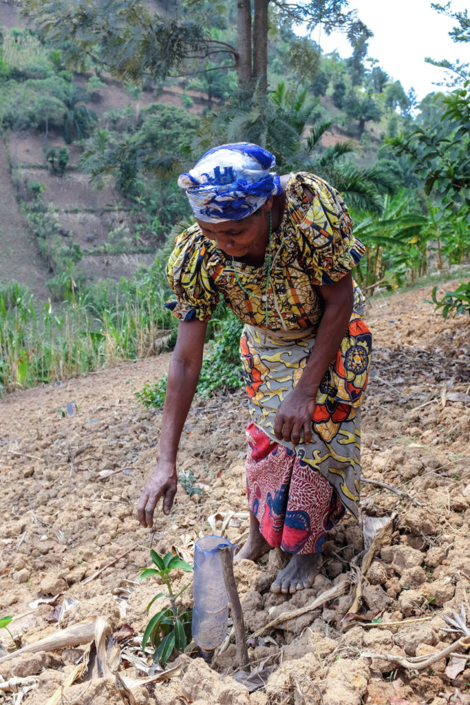
The livelihoods of the majority of the Burundian population depend on agriculture. However, the people face several constraints, including a significant decrease in agricultural production in the face of very rapid population growth. This is compounding the country’s issues with self-sufficiency and food security.
The decline in soil fertility is linked to several factors including erosion, particularly on steeply sloping land. The physical loss of land can reach 100 metric tons per hectare (mt/ha) per year in the Mirwa escarpments, and the nutrients in the soils are washed away in the runoff. Erosion control practices, such as plant cover, are often not integral or continuous. Poor cultivation practices, such as cultivation in the direction of the slope, also contribute to erosion. Moreover, most land with agricultural potential is affected by soil acidity, resulting in leaching of nutrients or a reduction in their assimilation by plants, especially in the case of phosphorus. The use of agricultural lime to correct this problem remains a major challenge for Burundian agriculture because many farmers are not aware of the product or do not know how to apply it.
Fertilizer use in Burundi remains low despite an increase in orders through the National Fertilizer Subsidy Program in Burundi (PNSEB) each year. Fertilizers that are only accessible through this program are often not available when needed. Thus, application by farmers is late, which reduces the effectiveness. The insufficiency or the non-use of biomass produced at farm level is another factor affecting soil fertility, as only a few farmers have livestock and opportunities to obtain off-farm organic matter are limited. Bad farming practices such as slash-and-burn cultivation also reduce soil fertility.
In Burundi, as in other places, soil fertility and acidification are dynamic across time and space. Therefore, it is necessary to have current data that will allow farmers to restore the soil considering the realities of the area. Using this logic, updated soil acidity and fertility maps are essential decision-making tools for profitable and sustainable agriculture, applying the best recommendations for fertilization and soil amendment.
Timeline of Soil Fertility Maps for Burundi
Soil Maps from 1990
During this time, analyses of the Burundian soils focused on 675 profiles, making it possible to establish soil maps at a scale of 1:50,000. These maps, produced by the Institute of Agronomic Sciences of Burundi (ISABU), were handwritten on 42 boards.
Soil Maps from 2013
After more than 20 years with no updates on the state of soil fertility, IFDC, ISABU, and the Directorate of Soil Fertility (DFS) of the Ministry of the Environment, Agriculture and Livestock (MINEAGRIE), in collaboration with the Kenyan laboratory Crop Nutrition Laboratory Services (Cropnuts), produced soil fertility maps using the results of analyses of soil samples taken from 1,039 georeferenced sites, distributed across all provinces of Burundi. These national maps, which also provided information on the trace element content of the soil, contributed to the initiation of trials on new soil fertilization recommendations and the integration of dolomite into the national fertilizer subsidy program in Burundi (PNSEB), as they showed that 27.7% of cultivated land was affected by soil acidification, at a pH of less than 5.
2022 Soil Maps
The latest soil fertility maps were produced through a collaboration between ISABU, MINEAGRIE, and IFDC in 2022. These maps take additional parameters into consideration and increase data accuracy. While the 2013 maps were limited to the national scale, those of 2022 also reach the level of agroecological zone and province. They have been easy to popularize, as the maps are accompanied by explanatory booklets for each province in the national language.
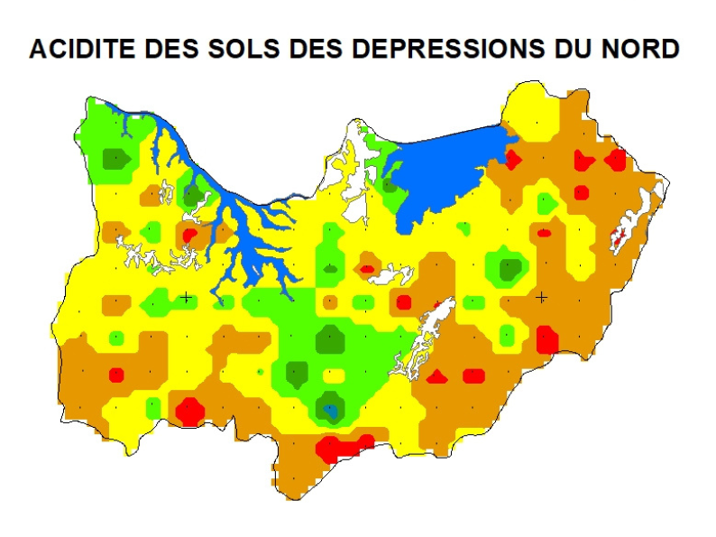
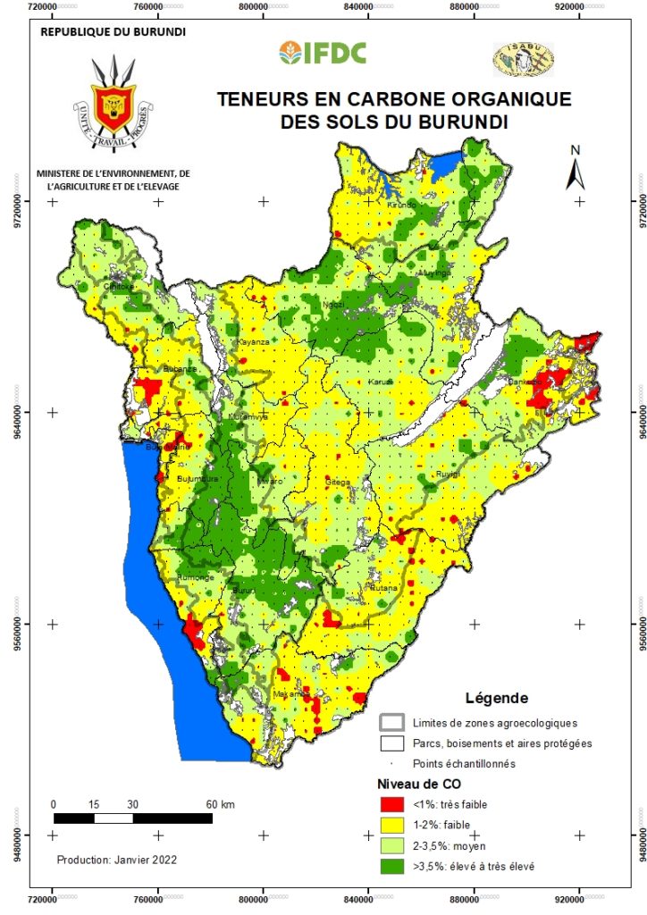
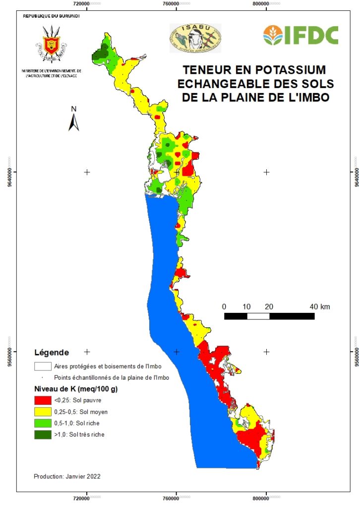
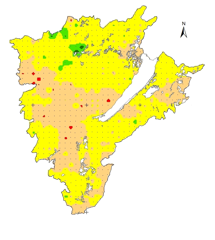
The maps, validated in February 2022, were produced with the ArcGIS software using the analyses conducted by the ISABU Soil and Food Products Analysis Laboratory (LASPA) on 1,376 soil samples collected throughout the country. The national-level maps provide information on the following parameters by agroecological zone: pH, soil organic carbon (SOC), total nitrogen (N), exchangeable calcium (Ca), exchangeable magnesium (Mg), exchangeable potassium (K), available phosphorus (P), and the C/N, Ca/Mg, Mg/K and (Ca+Mg)/K ratios. The provincial maps are limited to four parameters: pH, N, P, and K.
Conclusions Drawn from the 2022 Burundi Soil Acidity and Fertility Mapping
- The majority of the soils in Burundi (73%) are strongly to very strongly acidic (pH ≤ 5.5). This represents an area of 1,651,625 ha with agricultural potential, whether under cultivation or not. The areas most affected by acidity are the Congo Nile ridge, the central plateaus, and the Mumirwa escarpments. The Imbo plain and the northern depressions are less acidic; these two areas have high levels of Ca and Mg.
- The SOC is average at 40.1% for Burundi, while it is low in 48.2% of the country. The eastern depressions and the Imbo plain have low SOC contents.
- Phosphorus deficiency is widespread throughout the country, aggravated by erosion. This deficiency affects 98.8% of the agricultural land.
- K deficiency is recorded in 52.2% of the land, likely due to erosion, leaching, and uptake by crops.
- The exchangeable bases have low contents for Ca, Mg, and K or are in unbalanced ratios.
- Some regions need calcareous lime, while others require the addition of dolomitic lime.
Recommendations Made from the 2022 Mapping
- Soil acidity should be corrected using dolomitic lime, which is quantitatively and qualitatively available in Burundi. An awareness campaign for farmers should be conducted on a large scale so that they can better understand the benefits of using agricultural lime and master its application. Efforts should be made to improve the current recommendations on liming; the approaches that have been adopted by the various stakeholders in the agriculture sector are not harmonized.
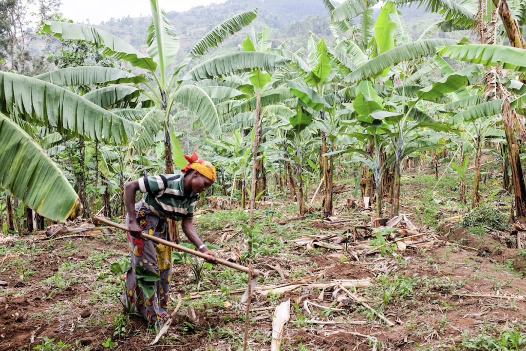
- Measures to maintain soil fertility, such as recycling biomass and the use of compost or manure, should be adopted. The supply of these materials remains a priority in all agro-ecological zones.
- Erosion must be controlled to limit the loss of nutrients.
- The type and dosage of dolomite and fertilizer should be adapted to the specificities of each area.
- The application of Integrated Soil Fertility Management (ISFM) will help to restore and improve soil fertility in Burundi.
Access the 2022 Burundi Soil Maps
Capitalization: 2022 Maps Have Already Produced Results
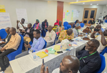
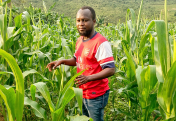
The soil fertility maps have helped raise awareness of soil fertility issues, as the provincial and municipal administrations, the agricultural technicians from the Provincial Office for the Environment, Agriculture and Livestock (BPEAE), and partners were able to receive these maps and the related explanatory booklets. This allowed them to understand the issues with soil fertility in Burundi and see the need to take action. In addition, the cartography, supplemented by an optimization study of the dolomite sector in Burundi, has highlighted the seriousness of soil acidity. This led to the implementation of a dolomite pilot project, coordinated by IFDC with financial support from the Embassy of the Kingdom of the Netherlands. Beginning in season 2023A, the project has already impacted approximately 3,944 ha of acidic land (pH ≤ 5.5), distributed across nine provinces and 25 municipalities and 72 hills, with 9,280 mt of dolomite made available to households. This project involves nine supervisory organizations, four dolomite production companies, and state partners, as well as ISABU for quality control. A total of 298 demonstration fields integrating ISFM practices have been established as part of rural learning and technology transfer.
Who Uses These Soil Fertility Maps?
These maps are of great interest to decision-makers and technicians, who use them as decision-making tools in guiding soil fertilization recommendations. They are an important database for research and educational institutions. They are also widely used by the extension service and those involved in rural development. The main beneficiary, however, is the farmer, who uses these maps to enhance the actual soil fertility conditions on his or her farm to contribute to profitable production.
Conclusion
The soil fertility maps, produced through a collaboration between ISABU, IFDC, and MINEAGRIE and validated in February 2022, are a valuable tool that improves the understanding of current problems of acidity and declining soil fertility in Burundi, which vary by agroecological zone. This justifies the orientation of the country toward recommendations of fertilization and amendment of the soils considering the zonal specificities. These maps have been highly appreciated and have already been valuable in certain initiatives and pilot projects.